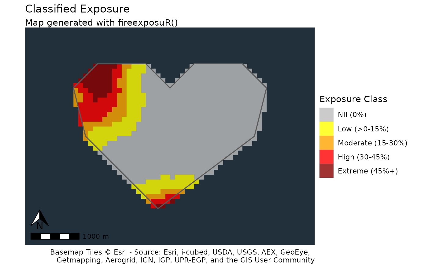
fire_exp_map_class() produces a standardized map of exposure with
exposure classes. This function dynamically pulls map tiles for a base map,
so it is recommended the area of interest is localized. The zoom level may
need to be adjusted based on the extent of your data; see
OpenStreetMap Wiki for
more information on zoom levels.
For mapping large extents it is recommended (and will be faster) to use
fire_exp_map_cont() which does not use base maps.
Scales and colors are determined by the parameter classify
which can be set to "local" or "landscape".
Landscape classification breaks are:
Low (0-20%)
Moderate (20-40%)
High (40-60%),
Very High (60-80%)
Extreme (80-100%)
Local classification breaks are:
Nil (0%)
Low (>0-15%)
Moderate (15-30%)
High (30-45%)
Extreme (45%+)
Usage
fire_exp_map_class(exposure, classify = c("local", "landscape"), aoi, zoom)Arguments
- exposure
SpatRaster (e.g. from
fire_exp())- classify
character, either
"local"or"landscape"to specify classification scheme to use.- aoi
SpatVector of an area of interest to mask exposure
- zoom
(Optional). numeric, set the zoom level for the basemap based on the extent of your data if defaults are not appropriate. Defaults if:
classify = "local"the zoom level default is13classify = "landscape"the zoom level default is6
Examples
# read example hazard data ----------------------------------
filepath <- "extdata/hazard.tif"
haz <- terra::rast(system.file(filepath, package = "fireexposuR"))
# generate example AOI polygon -----------------------------
filepath <- "extdata/builtsimpleexamplegeom.csv"
g <- read.csv(system.file(filepath, package = "fireexposuR"))
v <- terra::vect(as.matrix(g), "polygons", crs = haz)
# ----------------------------------------------------------

exp <- fire_exp(haz)
fire_exp_map_class(exp, classify = "local", v)
